


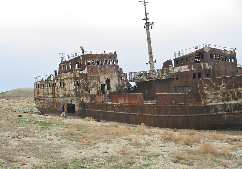
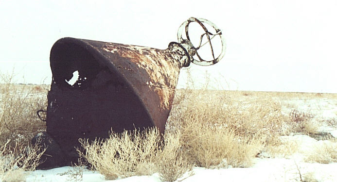
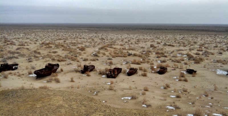
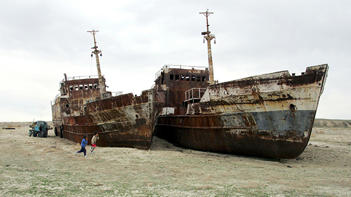
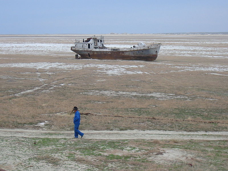
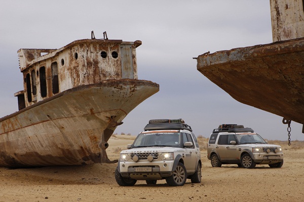
The Aral Sea formed about 5.5 million years ago due to a fall in sea level and the uplift of the Elburz and Caucasus Mountains. The shrinking of the Aral Sea has been called “one of the planet’s worst environmental disasters”. The region’s once-prosperous fishing industry has been essentially destroyed, bringing unemployment and economic hardship. The Aral Sea region is also heavily polluted, with consequential serious public health problems.
In the early 1960s, the Soviet government decided the two rivers that fed the Aral Sea, the Amu Darya in the south and the Syr Daryain the east, would be diverted to irrigate the desert, in an attempt to grow rice, melons, cereals, and cotton.
This was part of the Soviet plan for cotton, or “white gold”, to become a major export. This temporarily succeeded, and in 1988, Uzbekistan was the world’s largest exporter of cotton.
The construction of irrigation canals began on a large scale in the 1940s. Many of the canals were poorly built, allowing water to leak or evaporate. From the Qaraqum Canal, the largest in Central Asia, perhaps 30 to 75% of the water went to waste. Today, only 12% of Uzbekistan’s irrigation canal length is waterproofed.
Of the 47,750 km of interfarm irrigation channels in the basin, only 28% have antifiltration linings. Only 77% of farm intakes have flow gauges, and of the 268,500 km of onfarm channels, only 21% have anti-filtration linings, which retain on average 15% more water than unlined channels.
By 1960, between 20 and 60 km3 (4.8 and 14.4 cu mi) of water were going each year to the land instead of the sea. Most of the sea’s water supply had been diverted, and in the 1960s, the Aral Sea began to shrink. From 1961 to 1970, the Aral’s level fell at an average of 20 cm (7.9 in) a year; in the 1970s, the average rate nearly tripled to 50–60 cm (20–24 in) per year, and by the 1980s, it continued to drop, now with a mean of 80–90 cm (31–35 in) each year. The rate of water usage for irrigation continued to increase; the amount of water taken from the rivers doubled between 1960 and 2000, and cotton production nearly doubled in the same period.
The disappearance of the lake was no surprise to the Soviets; they expected it to happen long before. As early as 1964, Aleksandr Asarin at the Hydroproject Institute pointed out that the lake was doomed, explaining, “It was part of the five-year plans, approved by the council of ministers and the Politburo. Nobody on a lower level would dare to say a word contradicting those plans, even if it was the fate of the Aral Sea.”
The reaction to the predictions varied. Some Soviet experts apparently considered the Aral to be “nature’s error”, and a Soviet engineer said in 1968, “it is obvious to everyone that the evaporation of the Aral Sea is inevitable.” On the other hand, starting in the 1960s, alarge-scale project was proposed to redirect part of the flow of the rivers of the Ob basin to Central Asia over a gigantic canal system. Refilling of the Aral Sea was considered as one of the project’s main goals. However, due to its staggering costs and the negative public opinion in Russia proper, the federal authorities abandoned the project by 1986.
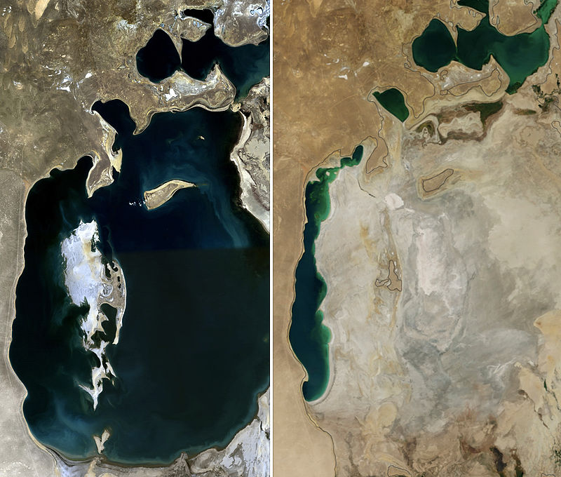
From 1960 to 1998, the sea’s surface area shrank by about 60%, and its volume by 80%. In 1960, the Aral Sea had been the world’s fourth-largest lake, with an area around 68,000 km2 (26,000 sq mi) and a volume of 1,100 km3 (260 cu mi); by 1998, it had dropped to 28,687 km2 (11,076 sq mi) and eighth largest. Over the same time period, its salinity increased from about 10 g/l to about 45 g/l.
In 1987, the continuing shrinkage split the lake into two separate bodies of water, the North Aral Sea (the Lesser Sea, or Small Aral Sea) and the South Aral Sea (the Greater Sea, or Large Aral Sea).
In 1991, Uzbekistan gained independence from the Soviet Union. Craig Murray, a UK ambassador to Uzbekistan in 2002, described the independence as a way for Islam Karimov to consolidate his power rather than a move away from a Soviet-style economy and its philosophy of exploitation of the land. Murray attributes the shrinkage of the Aral Sea in the 1990s to Karimov’s cotton policy.
The government maintained a massive irrigation system which Murray described as massively wasteful, with most of the water being lost through evaporation before reaching the cotton. Crop rotation was not used, and the depleted soil and monoculture required massive quantities of pesticides and fertilizer. The run off from the fields washed these chemicals into the shrinking sea, creating severe pollution and health problems. Murray compared the system to the slavery system in the pre-Civil War United States; forced labor was used, and profits were siphoned off by the powerful and well-connected. Murray contrasts this to Kazakhstan, where the cotton industry had been privatized.
By summer 2003, the South Aral Sea was vanishing faster than predicted. In the deepest parts of the sea, the bottom waters were saltier than the top, and not mixing. Thus, only the top of the sea was heated in the summer, and it evaporated faster than would otherwise be expected. In 2003, the South Aral further divided into eastern and western basins.
In 2004, the Aral Sea’s surface area was only 17,160 km2 (6,630 sq mi), 25% of its original size, and a nearly five-fold increase in salinity had killed most of its natural flora and fauna. By 2007, the sea’s area had further shrunk to 10% of its original size, and the salinity of the remains of the South Aral had increased to levels in excess of 100 g/l. (By comparison, the salinity of ordinary seawater is typically around 35 g/l; the Dead Sea’s salinity varies between 300 and 350 g/l.) The decline of the North Aral has now been partially reversed following construction of a dam (see below), but the remnants of the South Aral continue to disappear and its drastic shrinkage has created the Aralkum, a desert on the former lake bed.