


The area known as Doggerland is a real-life Atlantis from a time when the British Isles were neither British nor Isles.
The land occupied a great portion of where the waters of the North Sea extend nowadays.
After the last major Ice Age, some 12,000 years ago, the area got flooded over time by the rising sea levels.

Just like London mudlarks retrieve all sorts of memorabilia and historical items from the Thames riverbed, fishermen in the North Sea have reported findings including ancient bones, artifacts, and 9,000-year-old tools.
Dutch and British archaeologists and paleontologists were immediately interested by the discoveries as they were evidence for the existence of Doggerland.

Named after the Dogger Bank, Doggerland was first mentioned in a book A Story of the Stone Age by H.G. Wells, written in the late 19th century. The book suggested the existence of a prehistoric region that fused Britain’s east coast with the European mainland.
Archaeologists at the University of Bradford are working on a huge project to reconstruct the ancient Doggerland landscape which is now underneath the sea.
They are aiming to produce a 3D chart of the landscape with the help of seabed mapping data gathered by energy companies.

In the meantime, scientists wait on core sediment samples to extract DNA fragments from plants and animals, so that we can learn more about the flora and fauna that once existed.
Before the last glacial period, the vast piece of land that connected Europe and Britain consisted of a diverse mix of gentle hills, swampland, and dense forests.
With the lessening of the huge weight of ice, melting water got locked away which caused the land to tilt in an isostatic adjustment.

The ancient region was inhabited by thousands of Mesolithic Stone Age settlers. It was also a very important land bridge between Europe and Britain.
According to the evidence gathered, scientists believe that the Doggerlanders were nomadic hunter-gatherers who migrated with the season. They lived on hunting, fishing, and gathering foods such as berries, nuts, and mushrooms.

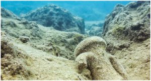
For hundreds of years, fishermen have pulled up all kinds of finds in their nets in the area off the coast of Dogger Bank.
In 1931, there was a famous discovery of a lump of peat which contained an ornate barbed antler point used for harpooning fish. It was hauled up near the Ower Bank, 25 miles off the English coast.

It is most likely that Doggerland was habitable until 10,000 BC and that the last remaining island was flooded in a single gigantic event some 8,000 years ago.
There was an enormous landslide off the coast of Norway, the Storegga Slide, in which an estimated 180-mile length of the coastal shelf crashed in the Norwegian Sea. That triggered a tsunami in the North Atlantic Ocean with waves up to 17 feet in height.

“The only populated lands on earth that have not yet been explored in any depth are those which have been lost underneath the sea,” says Professor Vince Gaffney, Anniversary Chair in Landscape Archaeology at the University of Bradford.
The study of this long-forgotten, sunken Stone Age habitat is important so that we can learn about the ultimate outcomes of potentially rising sea levels.
Experts who study and research Doggerland are attempting to connect the events that caused the disappearance of the land with present day possibilities.
Some scientists believe that a similar situation could happen if the polar ice caps melt, potentially affecting more than one billion people who live within 37 miles of a shoreline.
Rising sea level has been a serious threat throughout time, not just an ancient tale about Atlantis or Doggerland. The glacial melt once caused the destruction of the home of the Mesolithic people as well.