Like us on Facebook
Follow us on Instagram
 

The Frozen Niagara Falls- Interesting photos show the Falls during Cold winters of the past

Ian Smith

Niagara Falls  is the collective name for three waterfalls that straddle the international border between Canada and the United States; more specifically, between the province of Ontario and the state of New York. They form the southern end of the Niagara Gorge.From largest to smallest, the three waterfalls are the Horseshoe Falls, the American Falls and the Bridal Veil Falls. The Horseshoe Falls lie mostly on the Canadian side and the American Falls entirely on the American side, separated by Goat Island. The smaller Bridal Veil Falls are also located on the American side, separated from the other waterfalls by Luna Island. The international boundary line was originally drawn through Horseshoe Falls in 1819, but the boundary has long been in dispute due to natural erosion and construction

The features that became Niagara Falls were created by the Wisconsin glaciation about 10,000 years ago. The same forces also created the North American Great Lakes and the Niagara River. All were dug by a continental ice sheet that drove through the area, deepening some river channels to form lakes, and damming others with debris. Scientists argue that there is an old valley, buried by glacial drift, at the approximate location of the present Welland Canal.

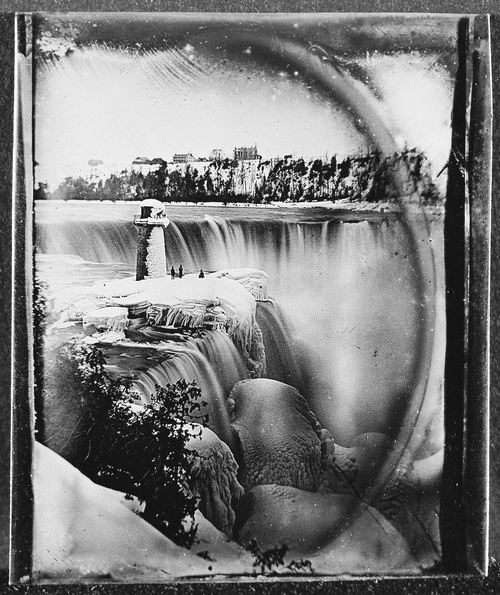
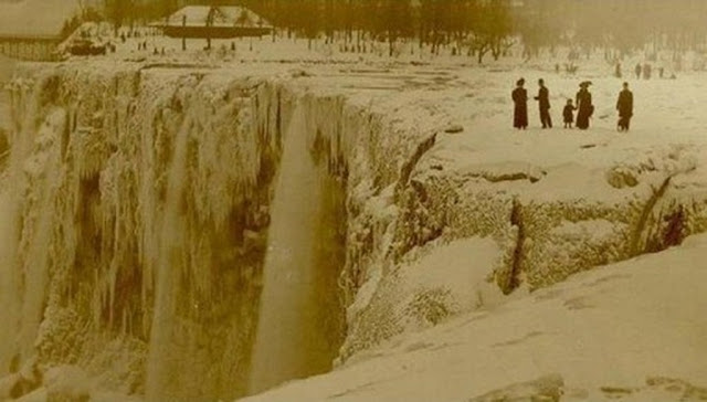
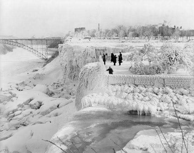
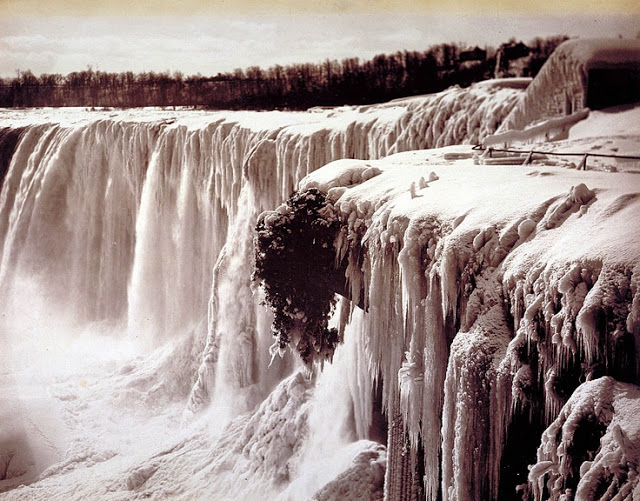
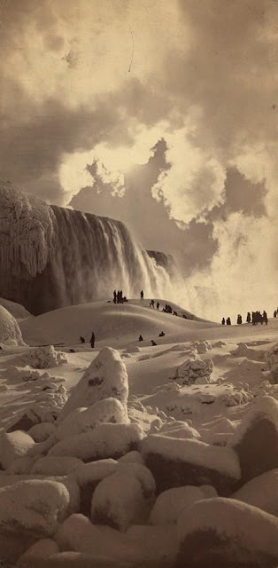
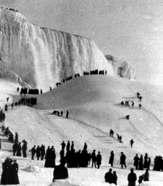
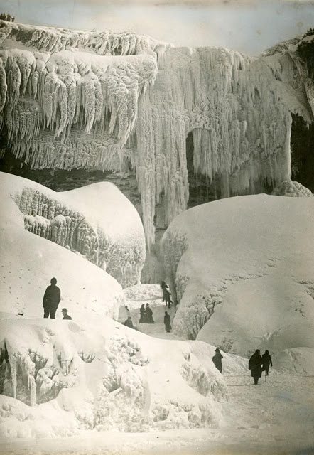
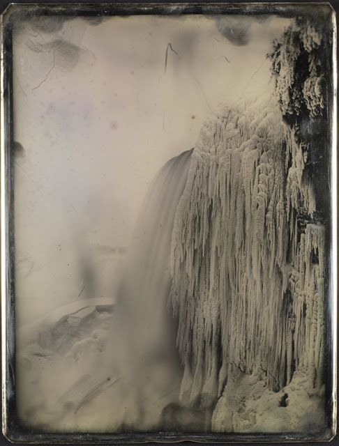
Niagara falls and its colossal volume of water almost never stops flowing, but when the temperatures drop below zero the falling water and mist create ice formations along the banks of the falls and river. That is when Niagara Falls become a winter wonderland.

A cave behind Horseshoe Falls, Niagara Falls, 1917


American Falls from below prospect point, Niagara, ca. 1850


Cave of the Winds in Winter, Niagara Falls, ca. 1900s


Frozen Niagara Falls, 1885


Ice Bridge, Niagara Falls, 1912


Niagara Fall, 1903
Niagara Fall, 1903


Niagara Falls completely frozen over in 1911
 The volume of water approaching the falls during peak flow season may sometimes be as much as 225,000 cubic feet (6,400 m3) per second. The average annual flow rate is 85,000 cubic feet (2,400 m3) per second. Since the flow is a direct function of the Lake Erie water elevation, it typically peaks in late spring or early summer. During the summer months, at least 100,000 cubic feet (2,800 m3) per second of water traverses the falls, some 90% of which goes over the Horseshoe Falls, while the balance is diverted to hydroelectric facilities. This is accomplished by employing a weir with movable gates upstream from the Horseshoe Falls. The falls’ flow is further halved at night, and, during the low tourist season in the winter, remains a minimum of 50,000 cubic feet (1,400 m3) per second. Water diversion is regulated by the 1950 Niagara Treaty and is administered by the International Niagara Board of Control


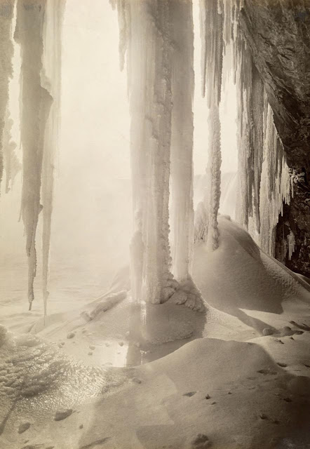
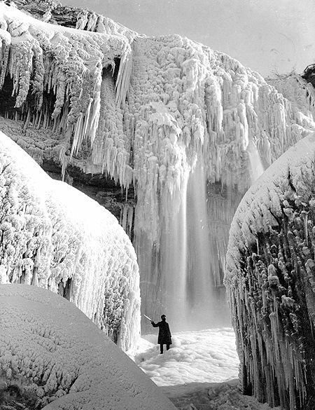
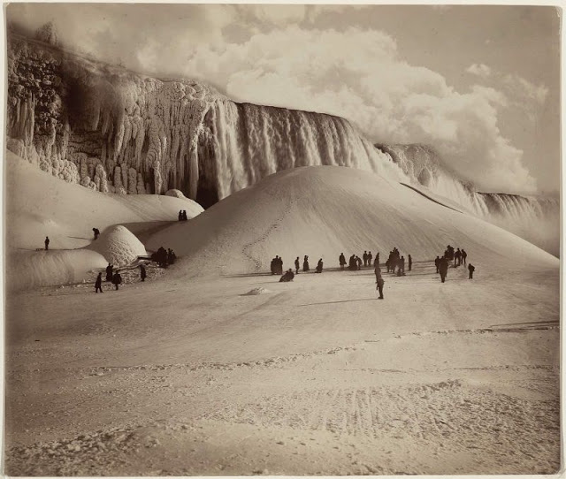
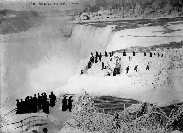
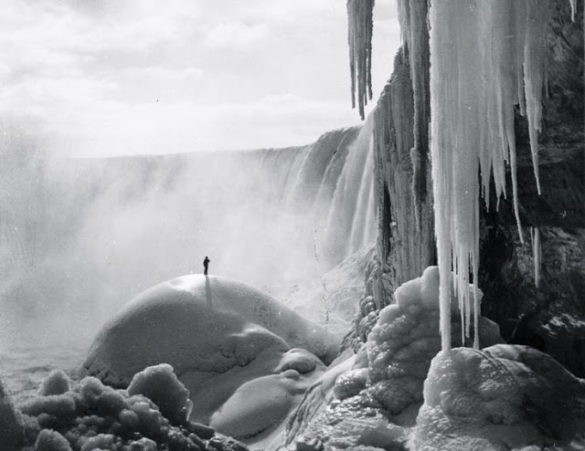
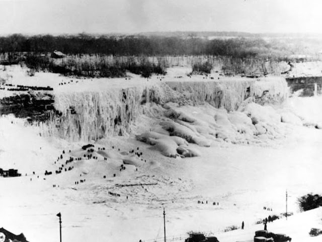
In January 1912, Niagara Falls saw a record low temperature for the twentieth century .That area also saw the longest stretch of below-zero weather for a single winter. Niagara Falls froze so densely that some people were able to safely cross on ice bridges.

Niagara Falls during the winter, ca. 1850s


Niagara Falls frozen in 1911


Niagara Falls frozen over, 1933


Niagara Falls, ca.1890


Visitors at frozen Niagara Falls, 1883


Visitors at Niagara Falls, 1911


Visitors explore the Cave of the Winds, Niagara Falls, 1916

Ian Smith

Ian Smith is one of the authors writing for The Vintage News