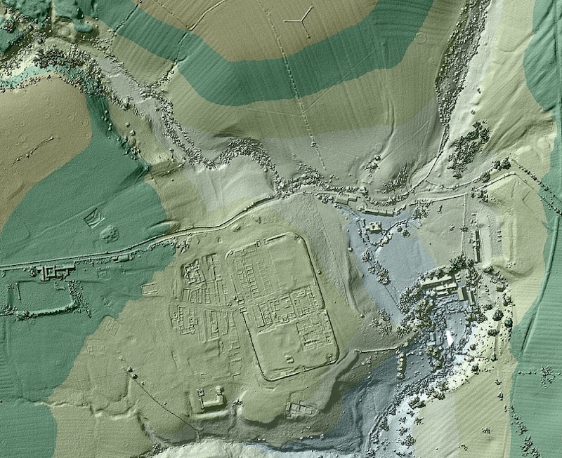
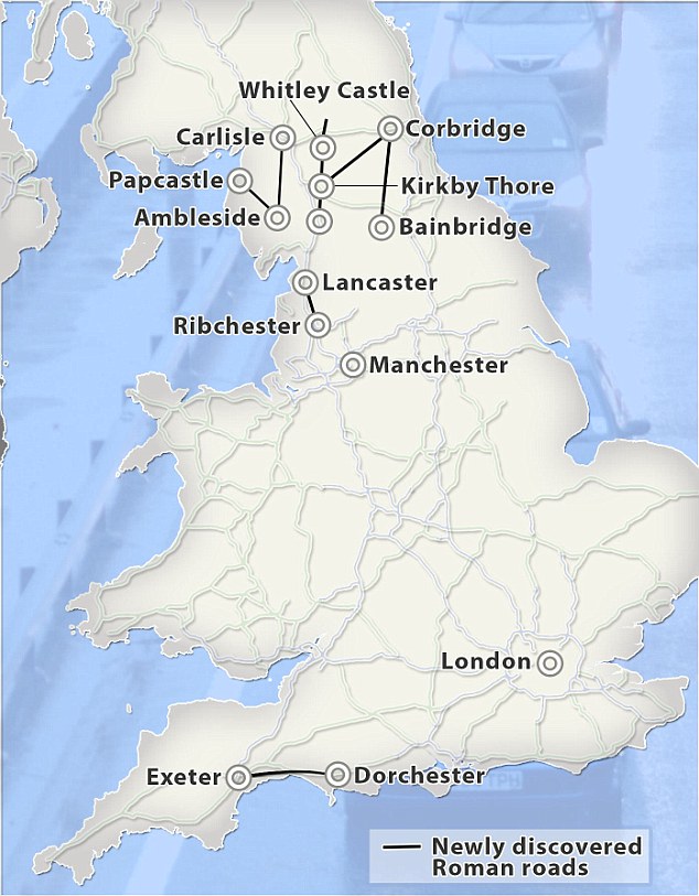
Recent aerial flood maps of Britain that were just taken reveal a lot more than the current at-risk regions. The photos show several old Roman roads buried in Britain.
After this discovery, archaeologists have started using flood-mapping technology to trace the paths of the Roman roads. It appears the roads have been buried under the British land for over 1,600 years.
The aerial flood maps were created by airplanes equipped with laser scanners. Those scanners were able to measure the distance between the airplane and the ground. By using light detection and ranging equipment, otherwise known as Lidar technology, the Environment Agency was able to detect which regions of Britain are the most at risk for flooding.
Lidar technology is able to detect differences in the height of the land down to five centimeters, and can in this way find hidden structures like the Roman roads buried under the land.

Credit: Environmental Agency
Lidar technology has been around for almost 20 years, but it has only been available to the Environment Agency. As of 2013, the Lidar technology has finally been made available to the public.
In the two years since the technology was made public, local archaeologists have used it to find seven lost Roman roads across the country. A retired road engineer, David Ratledge, said that it was great being able to find these roads and solve a puzzle – he had been working on finding those roads for decades. Ratledge is now 70 years old and is using his retirement to track down the United Kingdom’s network of ancient roads.
Ratledge has worked on exploring the fields in Lancashire for 45 years, desperately searching for a long-lost road. He finally discovered a 23-mile road between the towns of Ribchester and Lancaster by using the Lidar technology. It was as simple as that.
He also said that the road he found was the first “new” Roman road that had been found throughout the entire country in about 150 years, making the event even more exciting. He added that, given the age of the road, it is quite clear in several sections. He also found that one stretch of the Roman embankment was visible on Google Streetview; it’s quite amazing that no one had found the road before.
The reason Lidar technology was able to find the roads was because the roads were originally raised about 50 centimeters off the ground, making it easy for the radar to catch the difference in height. It is surprising that even little bits of the roads are visible, since there has been hundreds of years of erosion and farming in those areas. However, humans haven’t touched some parts of the roads, which is great for archaeologists.
Ratledge said he felt so relieved and happy to have finally found a road that he had spent decades searching. None of this could have happened without Lidar technology being available to the public.
This technology is a vast improvement over the human eye; it is so precise that it is effective in tracing the entire route of the old roads, even across the long distances. By using the photos from the radar, archaeologists are able to plot the raised sections on the map. This allows them to trace the original, full route of the road.

Archaeologists knew that there was an old Roman road between Ribchester and Lancaster and have been searching for it for decades. However, they have been looking in the wrong areas for years. By using the radar, their search was sped up immensely. Before the technology, the archaeologists used the information they knew – that the Romans generally took the shortest and most efficient routes from place to place. That meant the Romans must have used the road that ran northwest of Ribchester in a straight line to Lancaster.
However, the archaeologists were actually wrong with this assumption. The radar shows that the road was built along a line from Ribchester to Catterall in order to avoid steep hills, before eventually angling off to Lancaster. No one thought that the Romans might have avoided those hills, but thanks to the radar they now have new pieces of information.
Although it is fantastic the archaeologists have found six new roads, this is just the tip of the iceberg. They plan on using Lidar technology to unearth more hidden treasures worldwide. They already have over 11 terabytes of Lidar surveys to analyze; this could mean even more exciting findings are to come.