


The 1906 San Francisco earthquake struck the coast of Northern California at 5:12 a.m. on April 18 with an estimated “moment magnitude” of 7.8 and a maximum “Mercalli intensity” of “XI” (“Extreme”). Severe shaking was felt from Eureka on the North Coast to the Salinas Valley, an agricultural region to the south of the San Francisco Bay Area. Devastating fires soon broke out in the city and lasted for several days. As a result, about 3,000 people died and over 80% of the city of San Francisco was destroyed. The events are remembered as one of the worst and deadliest natural disasters in the history of the United States. The death toll remains the greatest loss of life from a natural disaster in California’s history and high in the lists of American urban disasters.
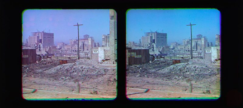
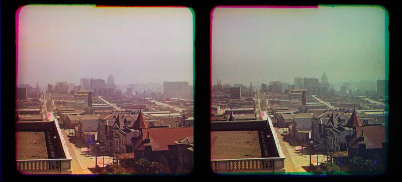
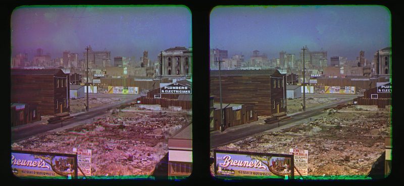
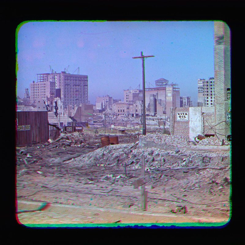
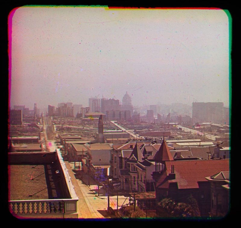
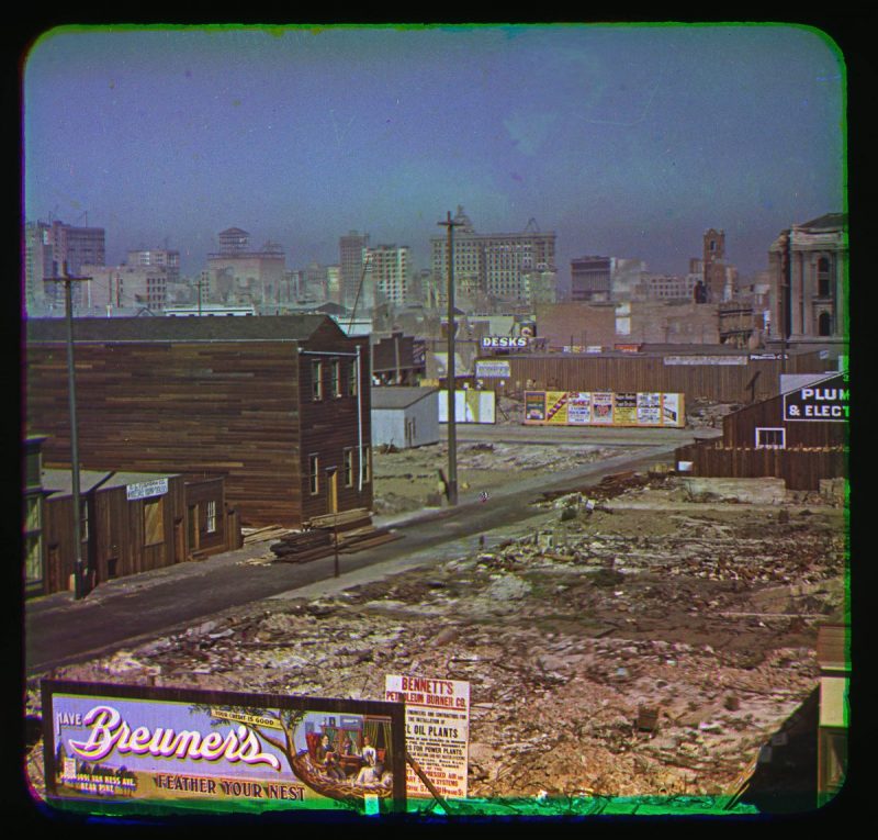
Five months later the inventor Frederick Eugene Ives visited the ruined city carrying his inventions: the photochromoscope. Photochromoscope was very early color and 3D Camera.
Images bySMITHSONIAN NATIONAL MUSEUM OF AMERICAN HISTORY
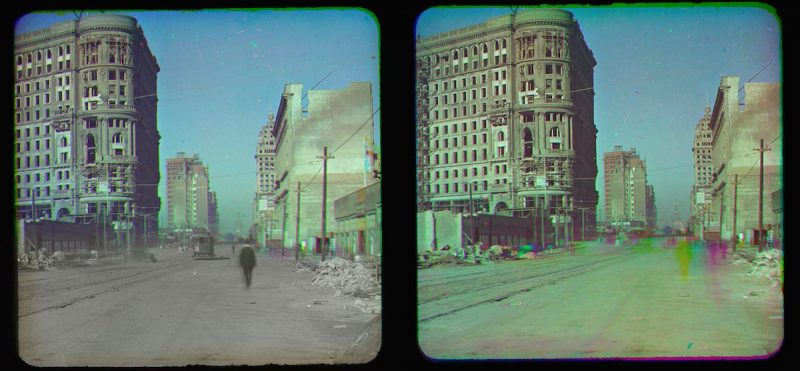
This stereo view includes an added layer on the left showing part of theoriginal Black and White separation with the image of a man walking and a trolley car. On the right you can see the effect of movement in this color process registering as color streaks.
The earthquake and fire left long-standing and significant pressures on the development of California. At the time of the disaster, San Francisco had been the ninth-largest city in the United States and the largest on the West Coast, with a population of about 410,000. Over a period of 60 years, the city had become the financial, trade and cultural center of the West; operated the busiest port on the West Coast; and was the “gateway to the Pacific”, through which growing U.S. economic and military power was projected into the Pacific and Asia. Over 80% of the city was destroyed by the earthquake and fire
Property losses from the disaster have been estimated to be more than $400 million.An insurance industry source tallies insured losses at $235 million, the equivalent to $6.19 billion in 2015 dollars
Almost immediately after the quake (and even during the disaster), planning and reconstruction plans were hatched to quickly rebuild the city. Rebuilding funds were immediately tied up by the fact that virtually all the major banks had been sites of the conflagration, requiring a lengthy wait of seven-to-ten days before their fire-proof vaults could cool sufficiently to be safely opened. The Bank of Italy had evacuated its funds and was able to provide liquidity in the immediate aftermath. Its president also immediately chartered and financed the sending of two ships to return with shiploads of lumber from Washington and Oregon mills which provided the initial reconstruction materials and surge. In 1929, Bank of Italy was renamed and is now known as Bank of America.