


Due to the rapid advancement of technology…
Columbus and Magellan had it rough. Exploration these days is quite literally an armchair activity, as high-resolution satellite images and tools like Google Earth make it possible for anyone with an Internet connection to pore over the globe with a fine-toothed comb. There are entire online communities devoted to finding and cataloging the most unusual locales worldwide, creating 21st century atlases of minutiae. It isn’t just for hobbyists, either — Google Earth has helped scientists find previously unknown ruins and police locate clandestine marijuana fields. Here are 10 of the most unusual discoveries.
— By Dan Fletcher
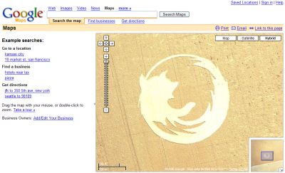
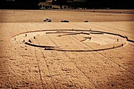
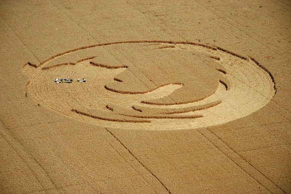
Firefox Crop Circles
Maybe alien technology isn’t so foreign after all. This Firefox crop circle sprouted up in a cornfield in Oregon, but its origins are no mystery. In 2006, the Oregon State University Linux Users group created the giant logo — spanning more than 45,000 sq. ft. — to celebrate the Web browser’s 50 millionth download.
Here’s a true Google Earth mystery. These odd formations can be found on air bases in the U.S. and Britain — this one comes from a base outside Norwich, England. The U.K. Ministry of Defense called it a motorcycle range, but other speculate it may be some sort of calibration tool for satellites. No one really knows — and the military isn’t saying anything more.
Missile Test?
Google Earth has plenty of examples of planes, helicopters — even hot air balloons — caught in flight, but this cruise missile, thought to have been fired during military training exercises in the Utah mountains, might be the most unlikely capture yet. If it is, in fact, a cruise missile. Many dispute the image and say it’s merely an airplane. You be the judge, but if you look closely, the “missile” appears to have wings.
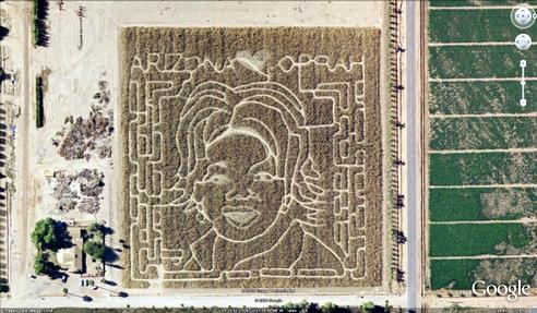

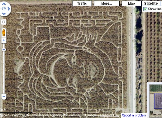
Oprah Maze
She’s got a massive syndicated show and a magazine called O, and she was dubbed the most powerful celebrity in the world by Forbes. Why shouldn’t Oprah get her own corn maze? An Arizona farmer created this 2004 tribute to the TV talk-show host.
Iraq’s Bloody Lake
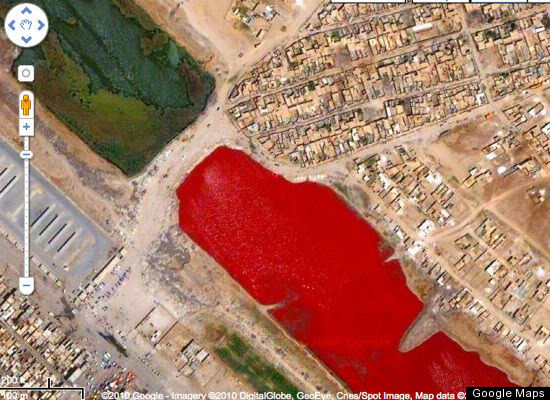
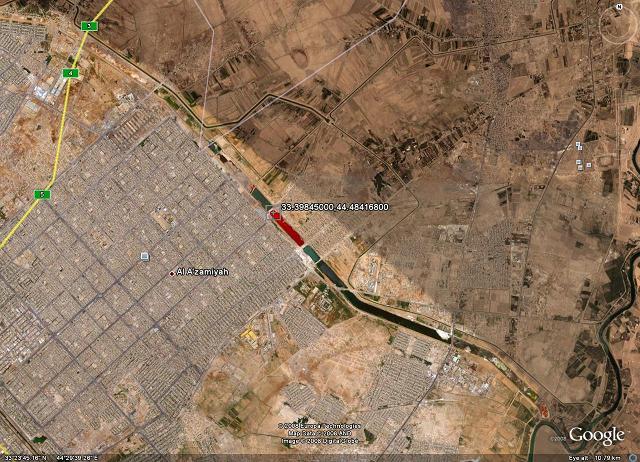
This blood-red lake outside Iraq’s Sadr City garnered a fair share of macabre speculation when it was noticed in 2007. One tipster told the tech blog Boing Boing that he was “told by a friend” that slaughterhouses in Iraq sometimes dump blood into canals. No one has offered an official explanation, but it’s more likely that the color comes from sewage, pollution or a water-treatment process.
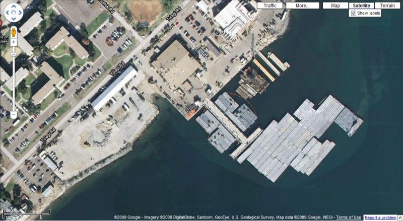
Lost (and found) at the sea
The S.S. Jassim, a Bolivian cargo ferry, ran aground and sunk on the Wingate Reef off the coast of Sudan in 2003. Now it’s one of the largest shipwrecks visible on Google Earth.
Airplane Graveyard
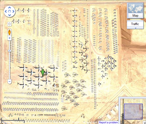
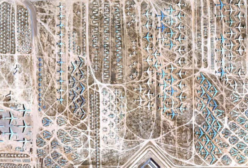
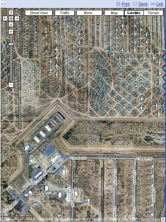
The Davis-Monthan Air Force Base outside Tuscon, Ariz., is where old planes go to die. More than 4,000 military aircraft are parked on the base, from B-52s to stealth bombers, where they are salvaged for parts and broken down for scrap. It’s one of the most popular satellite pictures online, making guided tours of the area a hot ticket.
Secret Swastika
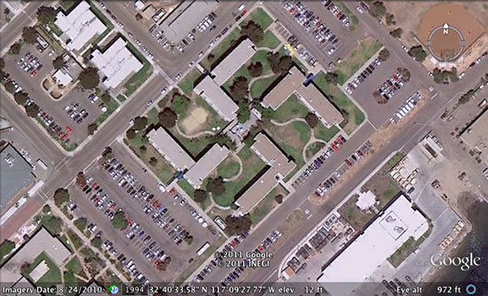

When builders of the Coronado Naval Amphibious Base in San Diego planned this complex in 1967, satellite imagery was probably the furthest thing from their minds. But in 2007, Google Earth sleuths found that four unconnected buildings on the base formed an unfortunate shape when viewed from above: a swastika. The Navy says it’s spending more than $600,000 to mask the shape. “We don’t want to be associated with something as symbolic and hateful as a swastika,” a spokesman said.
A Face in the Clay
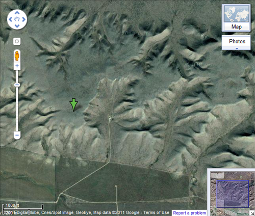
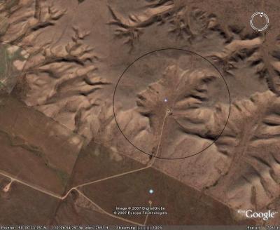
It looks disconcertingly like a face from above, but this formation in Alberta, Canada, is entirely natural. Dubbed the Badlands Guardian, the “face” is actually a valley eroded into the clay. Some say the person appears to be wearing earphones; that’s merely a road and an oil well. Even the Badlands Guardian, it seems, isn’t immune to exploratory drilling.
Atlantis Found
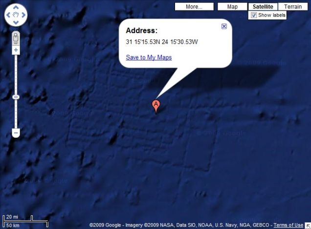
Might these be the ruins of the lost continent of Atlantis? Eager explorers certainly thought so, trumpeting this grid off the coast of Africa as streets in the mythical sunken city. Observers noted the area appeared to be the size of Wales, making such a large grid an impressive feat of ancient urban planning. The real explanation is far less fun: Google Earth engineers soon announced that the grid pattern was merely a digital artifact created by the sonar boats collecting mapping data. Whispers still linger, but it doesn’t look like anyone will be dredging up a forgotten civilization anytime soon.