


Just about everyone has heard of the San Andreas Fault running through California. Scientists have been studying the fault line for years, trying to predict the next major earthquake.
In 1970, another major fault line running for 700 miles, just 40 to 80 miles off the coast of the Pacific Northwest in the U.S. and Canada was discovered with the potential to cause an earthquake much more powerful than the San Andreas could, along with a tsunami that could travel as far as Japan and Southeast Asia.

The Cascadia Subduction Zone covers the area between Northern Vancouver Island and Cape Mendocino in California.
It is part of the Ring of Fire, a seismic belt that runs in a horseshoe-shape from the south of Australia up through the Philippines to the easternmost part of Russia, then directly east to Alaska’s Aleutian Islands, and down the west coast of Canada, the United States, Mexico, Central America, South America and west back toward Australia.
According to Encyclopaedia Britannica, most of the world’s strongest earthquakes and about seventy-five percent of the volcanoes on Earth are located in the Ring of Fire.

The Cascadia Subduction Zone is where the Pacific tectonic plate meets the Juan de Fuca tectonic plate which is moving westward and being pushed under the Pacific plate, and can eventually cause an earthquake which in turn can cause a tsunami. The larger the earthquake, the larger the tsunami.
In January 1700, that scenario actually took place when an earthquake believed to have reached from 8.7 to 9.2 on the Richter scale ripped through the entire Cascadia Zone. The resulting tsunami created ten-foot waves in Japan that, according to ScienceDaily lasted eighteen hours.

Written and oral history refer to a major earthquake on the west coast of the US and a tsunami in Japan, but no one knows exactly when the event occurred. During the 1980s and 1990s, scientists tested the “ghost forests” along the coast of Washington and Oregon.
These are stumps of western red cedar trees and other plant life that were destroyed all at one time as told by carbon dating and dendrochronology, the study of tree rings. All evidence shows the plant life stopped growing about the end of 1699. Soil samples from the ocean floor also attest to a major ecological event at this time.

Scientists like Chris Goldfinger, a paleoseismologist at Oregon State University, and his colleagues predict that the chance of a major earthquake along the Cascadia Zone within the next fifty years is one in three.
According to an article in The New Yorker written by Pulitzer Prize winning author Kathryn Schulz in 2015, Goldfinger predicts that the next earthquake will begin with compressional waves, fast-moving, high-frequency waves that are audible only to dogs and some other animals.

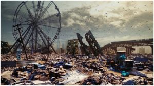
If such a scenario were to take place, the intensity of the quake would cause open chasms in the ground and walls of ocean water to flood in from the sea. Coastal towns and cities from southern Canada to southern California would be in danger. Many theories already exist that the next “Big One” could actually cut off California from the rest of the country. According to USA Today California is overdue for the next big earthquake. “There is a 99.9% chance that there will be a damaging quake (magnitude greater than or equal to 6.7) somewhere in California in the next 30 years,” said Peggy Hellweg, a seismologist at the University of California, Berkeley.
Read another story from us: Sea Serpent – Can the Giant Oarfish Predict Earthquakes?
The Ring of Fire covers some of the most populated places on Earth. The Pacific coast of the Americas are frequently rocked by earthquakes, open fissures in the heavily populated Hawaiian Islands are belching out lava, hurricanes plague the Gulf of Mexico, thousands live near Mt. St. Helens and over two million people live in the shadow of Mt. Vesuvius. Humans seem to have a habit of being attracted to dangerous locations.