An “Atlantis” of Britain has been identified by artifacts deep in the North Sea after scientists discovered underwater Stone Age settlements that could be 10,000 years old. One artifact researchers found in the seabed could even have been part of a prehistoric “personal tool kit.”
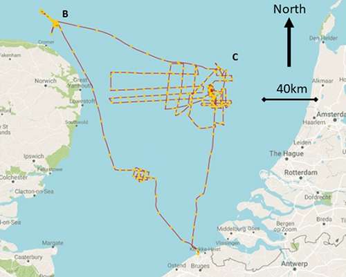
Scientists have located and explored an inhabited community that existed on the banks of an ancient river, now submerged, making this the first time archaeologists have found prehistoric artifacts this far from land and so deep underwater. A team of archaeologists from the UK and Belgium traveled 25 miles north of a village in Norfolk called Blakeney to find two stone artifacts, which confirm the existence of settlements.

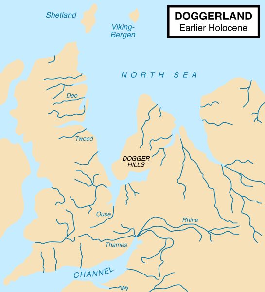
Considering the finds made by fishermen over the years, it has long been suspected that the southern North Sea hid a landscape that once was home to thousands of people. “For decades, fishers and oil exploration outfitters have reporting finding worked bone, stone, and human remains in Brown Bank, a marine ecosystem located 50 miles west of the Dutch coast,” said IFL Science.

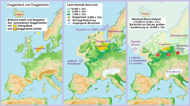
The Stone Age settlements were likely swallowed by the sea around 6000 BC. They could have flourished for a long time before being submerged, their peak being anywhere between 8200 and 7700 BC.
It’s easy to see why people wanted to live there. Sediment samples have provided pollen and other evidence that suggest the now-submerged areas would have been home to landscapes of plants and animals. “This would have been perfect for Mesolithic hunter-gathers in the Stone Age and their settlement location right next to the river would have been great for freshwater and fishing,” according to Fox News.

Marshland with rich reed beds would have provided large waterfowl to hunt, as well as reeds for making baskets and fish traps. “Inter-tidal mud flats and gravel beaches each provided access to different species of nutritious shellfish – and plentiful grey and common seals would have provided a seasonally rich source of very high-protein meat and fat,” according to the Independent. “Salt-marsh grassland would have attracted deer, elk and giant wild cattle (aurochs), which in turn would have provided a crucial supply of year-round meat to local humans.”

To figure out the best prospects for exploring, today’s researchers re-created the submarine landscape using data given to them by oil and gas companies, wind farm developers, and coal extractors. This way they were able to determine which areas would have been favored by Stone Age humans. Using acoustic techniques and extracting physical samples of the seabed, researchers found three sites that have the potential for more study.
Related Video:
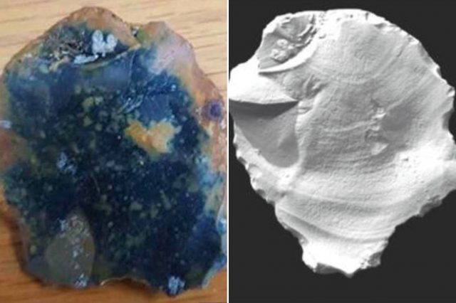
The first artifact they found was a large hammerstone, which archaeologists believe was used for making new flint tools. “As well as being evidence for flint tool production the hammer fragment derived from a large battered flint nodule would once have been part of a personal tool kit,” the scientists said. The second artifact found on the other side of the ancient river bed was a two-millimeter thick flake of flint that the archaeologists think was cut off when a stone tool was being made.
The researchers who discovered the artifacts said in their statement, “Prospecting this drowned landscape in search of the evidence of people is a challenging activity, as the North Sea is not only one of the busiest seaways in the world but the weather often makes it inhospitable. Further, multiple utilities cross the area and visibility underwater is often limited.”
Related Article: The Mysterious Underwater Land Mass Known as the ‘British Atlantis’
The next stage of the excavation is expected to require the services of an unmanned mini-submarine, which will take a closer look at the sea bed and use its robotic arms to collect more artifacts from the depths of the North Sea.
Nancy Bilyeau, a former staff editor at Entertainment Weekly, Rolling Stone, and InStyle, has written a trilogy of historical thrillers for Touchstone Books. Her new book, The Blue, is a spy story set in the 18th-century porcelain world. For more information, go to www.nancybilyeau.com
